3D Printing
[EN] Instruction for 3D Printing elevation data and generate a STL file from a GeoTIFF.
Get the Digital Elevation Model (DEM) of Iceland here:
For 3D printing the elevation model it is possible to follow this excellent guide:
You need the following software:
Here --> STL you find a ready to print example STL file generated following the guide. You can play with it directly in Blender or your 3D printer software to adapt the sizes to fit your printer settings.
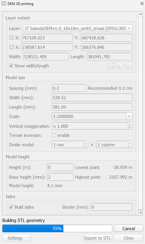
The model size is 528.52mmx381.04mm for a scale of 1:1'000'000.
_nobase means the base has been set to 0 instead of 2mm.
The default recommended spacing of 0.2mm is used.
The settings_1x.png shows the settings used to create the model with 1x vertical exageration.
Here you can download the 10m resolution DEM of Iceland in 10m resolution [3 GB of data!]
For more information of the QGIS plugin: https://plugins.qgis.org/plugins/DEMto3D/
License: CC4.0 - https://www.lmi.is/is/um-lmi/starfsemi/skilmalar-og-gjaldskra/gjaldskra, simply cite us 
For questions: lmi(hjá)lmi.is
Til baka á forsíðu